Geography in GOA
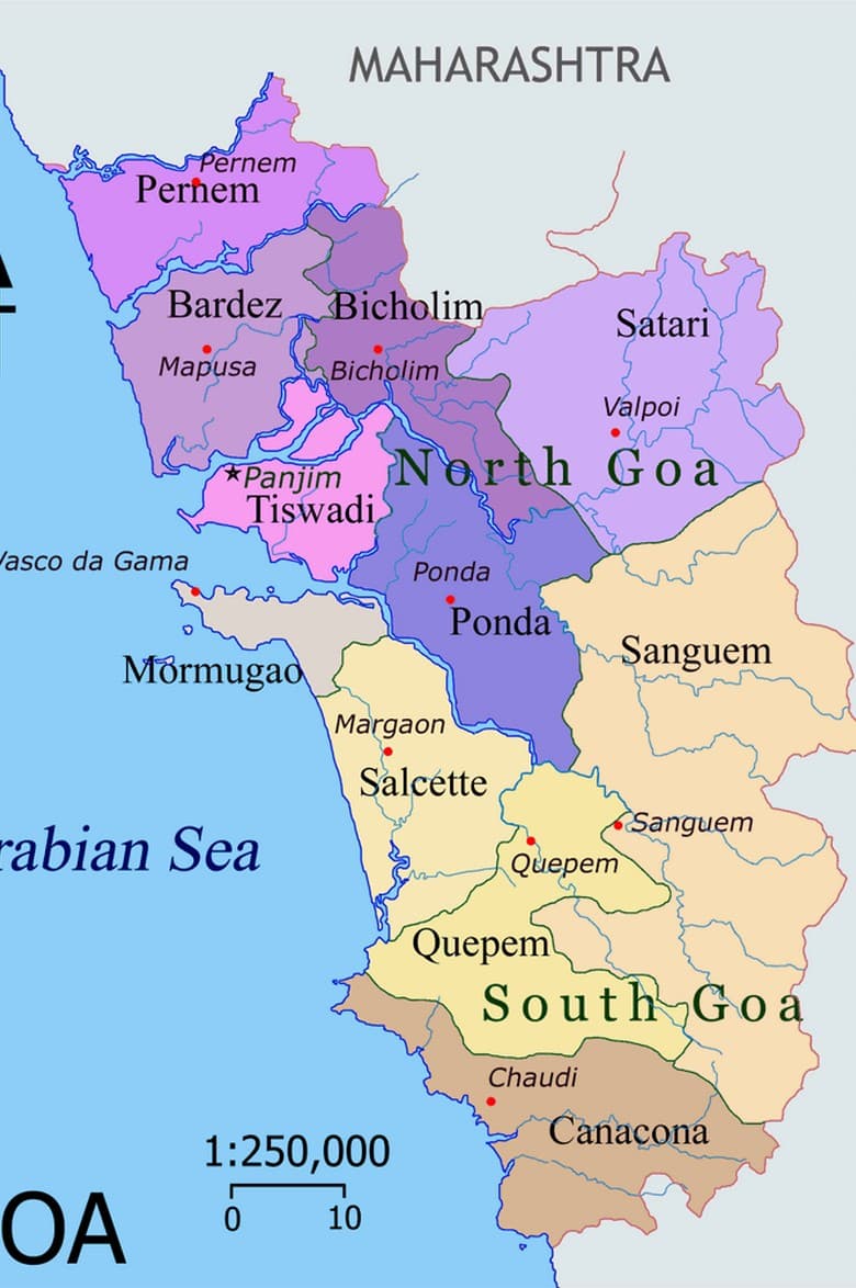
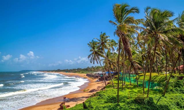
The state of Goa is geographically located on the western coast of the Indian peninsula which is separated from Maharashtra by the Terekhol River in the north, Karnataka in the South, the Western Ghats in the east, and the Arabian Sea in the West. It is known for its shorelines and picturesque beauty bordered by Maharashtra and Karnataka in the north and south.
Riverlike Mandovi, Tiracol, Zuari, Chapora, Sal, and Talpona structure the system route transporting goods, mining metals, and other agricultural items in Goa. As these waterways stream their normal path towards the sea, they divide into various estuaries and strait which extends the excellence of the coastline. Goa includes a huge portion of the Western Ghats. The highest mountain is Sonsogor in the Sahyadri range. Its rivers Tiracol, Chapora, Mandovi, Zauri, Sal, and Talpona have their root in the Sahyadri ranges and stream westbound into the Arabian Sea. The mouths of the two biggest waterways Mandavi and Zauri encompass the triangular island of Goa, the summit called the cape, being a rough headland isolating the harbour of Goa into two ports.
And so, with such great geographical features a tour to Goa is not only scenic but also a fun-filled and memorable one.
Top tour packages
Happy Travellers
Beautiful Memories with Flamingo Transworld
Dr. Kruti Patel
 Aug
AugA Dream Trip to France and Switzerland with Flamingo
Mr. Dharmesh Shah
 Aug
AugIncredible Europe Tour with Flamingo Transworld
Ms. Jyoti & Mr. Tushar
 Jul
JulWonderful Japan Trip Experience with Flamingo
Surabhi Udeshi
 May
MayUnforgettable Experience With Flamingo Transworld
Mr. Ambrish Shah
 Mar
MarAn Unforgettable Journey with Unnati and Flamingo !
Mr. Navneet Bisani
 Dec
DecWe are Thankful to Flamingo Tours And Travels
Mr. Vijay Shah
 Oct
OctExcellent Experience Southeast Trip With Flamingo Travels
Mr. Manoj Betai
 Jun
JunWonderful Trip with Flamingo Travels
Ms. Chetna Ajmera
 Jul
JulSuper Experience with Flamingo Travels
Shailesh Shah
 Jun
JunTrending travel articles

Affordable Bali Trip Under ₹30000 – Flamingo Transworld Budget Itinerary for First-Time Travelers
Summary: Looking for a budget-friendly Bali trip in 2026? This blog shows how you can enjoy a relaxing 5-day Bali Trip under ?30000/- by choosing smart stays, simple food and the right places. Perfect for first-time Indian travellers looking for a budget-friendly Bali holiday. We all have seen tons of pics of temples, Bali Swing, […]

Japan Tour Packages from India Under ₹3 Lakh – Explore Japan on a Budget
Summary: Your dream of exploring Japan is possible, even with a strict budget! This blog shares how Japan tour packages from India under ?3 lakh are possible. It covers real costs, budget tips, the best time to visit, and much more. It helps you understand how to save money and still enjoy a great Japan […]

Singapore Tour Packages from India Under ₹1 Lakh – Budget-Friendly Trips 2025-26
Summary: A trip to Singapore can fit your budget with the right plan. This blog explains how Singapore tour packages from India under ?1 lakh work, what costs to expect, and how to save money. It helps you understand the best places to visit in Singapore in 2026 so you can enjoy this island country […]

Top Indian Restaurants in Hanoi to Try in 2026!
Summary: Indian restaurants in Hanoi are more than just places to eat. They serve Indian food with a Vietnamese welcome. Whether you are a vegetarian, prefer halal food, or just miss home-style dal, these restaurants have it all. Every meal is served with care and a friendly smile, making you feel right at home in […]

Macau – A city that refuses to sleep , and wont let you either !
Summary: Macau Travel – Macau is a city that never slows down—filled with luxury hotels, thrilling attractions, endless nightlife, and unforgettable energy. From staying at The Venetian to breathtaking Macau Tower views and vibrant casinos, Muskan Golecha’s experience captures the true spirit of a city that you don’t just visit, you live! Macau is one […]

10 Days Itinerary for Switzerland – Perfect Trip Plan for First-Time Visitors!
Summary: If you want a calm, scenic, and well-paced trip, this 10 days itinerary for Switzerland is made for you. It suits families, honeymooners, seniors, and solo travellers. This plan combines top attractions with relaxed, easy travel days. It also keeps Indian comfort in mind. Read on to get the full day-by-day plan, smart tips, […]

Switzerland in Winter 2026: A Fairytale Experience of Snow, Alps & Christmas Markets!
Summary: Switzerland in winter 2026 is pure magic, snow-dusted Alps, glittering Christmas markets, and cozy wooden chalets bring fairytales to life. Whether you are sipping hot chocolate by the beautiful Swiss lakes or exploring the festive streets of cities, it feels like a movie. Perfect for Indian travellers, families, and honeymooners. This blog helps you […]

Christmas in Dubai 2025: Lights, Luxury & Festive Shopping!
Summary: Experience the magic of Christmas in Dubai 2025, where the city sparkles with lights, music, and festive cheer. From grand events to lively markets and fireworks, every corner feels joyful. Enjoy delicious food, family fun, and exciting shopping deals during the Dubai festive season. Plan your trip easily with Dubai Tour Packages and make […]

Bhutan In December 2025- Weather, Insider Tips, Best Time to Visit, and Things to Do!
Summary: Experience the magic of a trip to Bhutan in December 2025, with clear skies, vibrant festivals, fewer crowds, and stunning mountain views. This blog guides you through weather updates, travel tips, places to visit, and must-try experiences for your perfect Bhutan holiday. Plan your relaxing, crowd-free visit to Bhutan and experience the authentic charm […]

How to Plan A Budget Trip To Vietnam Under ₹60,000!
Summary: Trip To Vietnam Under ?60000 – Dreaming of travelling to Vietnam without stretching your wallet? This blog shares how to plan your trip to Vietnam under ?60,000. It shares everything, including flights, hotels, meals, and activities. Discover must-visit cities, real cost breakdown, and much more to make your Vietnam tour package memorable yet budget-friendly. […]


